Location utility-based map reduction
DownloadLeonard_Location utility.pdf (1.616Mb)
OPEN_ACCESS_POLICY
Open Access Policy
Creative Commons Attribution-Noncommercial-Share Alike
Terms of use
Metadata
Show full item recordAbstract
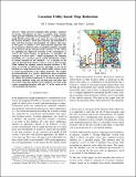
Maps used for navigation often include a database of location descriptions for place recognition (loop closing), which permits bounded-error performance. A standard pose-graph SLAM system adds a new entry for every new pose into the location database, which grows linearly and unbounded in time and thus becomes unsustainable. To address this issue, in this paper we propose a new map-reduction approach that pre-constructs a fixed-size place-recognition database amenable to the limited storage and processing resources of the vehicle by exploiting the high-level structure of the environment as well as the vehicle motion. In particular, we introduce the concept of location utility - which encapsulates the visitation probability of a location and its spatial distribution relative to nearby locations in the database - as a measure of the value of potential loop-closure events to occur at that location. While finding the optimal reduced location database is NP-hard, we develop an efficient greedy algorithm to sort all the locations in a map based on their relative utility without access to sensor measurements or the vehicle trajectory. This enables pre-determination of a generic, limited-size place-recognition database containing the N best locations in the environment. To validate the proposed approach, we develop an open-source street-map simulator using real city-map data and show that an accurate map (pose-graph) can be attained even when using a place-recognition database with only 1% of the entries of the corresponding full database.
Date issued
2015-07Department
Massachusetts Institute of Technology. Computer Science and Artificial Intelligence Laboratory; Massachusetts Institute of Technology. Department of Aeronautics and Astronautics; Massachusetts Institute of Technology. Department of Mechanical EngineeringJournal
Proceeding of the 2015 IEEE International Conference on Robotics and Automation (ICRA)
Publisher
Institute of Electrical and Electronics Engineers
Citation
Steiner, Ted J., Guoquan Huang, and John J. Leonard. “Location Utility-Based Map Reduction.” 2015 IEEE International Conference on Robotics and Automation (ICRA) (May 2015).
Version: Author's final manuscript
Other identifiers
INSPEC Accession Number: 15286382
ISBN
978-1-4799-6923-4
978-1-4799-6924-1
978-1-4799-6922-7