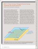
Ocean Acoustic Waveguide Remote Sensing: Visualizing Life Around Seamounts
DownloadMakris_Ocean acoustic.pdf (804.1Kb)
PUBLISHER_POLICY
Publisher Policy
Article is made available in accordance with the publisher's policy and may be subject to US copyright law. Please refer to the publisher's site for terms of use.
Terms of use
Metadata
Show full item recordAbstract
Collectively, seamounts form a significant biome the size of
Europe with important but heavily depleted fisheries (see
Box 12 on page 206 of this issue [Etnoyer et al., 2010]). Recently,
large seamount tracts have been put aside as protected areas
(see Pitcher et al., 2010). Yet, we remain largely ignorant of the
dynamics of fish and other nektonic organism movements around
seamounts. Hence, there is a pressing need for a survey tool to
effectively monitor how stocks respond to management closures,
and to determine which fisheries might actually be sustainable.
Date issued
2010-01Department
Massachusetts Institute of Technology. Department of Mechanical EngineeringJournal
Oceanography
Publisher
Oceanography Society
Citation
Makris, Nicholas C., Srinivasan Jagannathan and Anamaria Ignisca. "Ocean Acoustic Waveguide Remote Sensing: Visualizing Life Around Seamounts." Oceanography 23.1 (2010): p.204-205. © 2010 The Oceanography Society.
Version: Final published version
ISSN
1042-8275